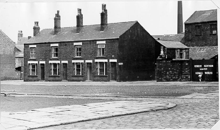
![[large brick building]](ardwickstentrancetobethalst.gif)
13k GIF 83k JPEG Ardwick Street and Liptrot Street leading onto Derby Street, entrance to Derby Street School. May 13th 1964.
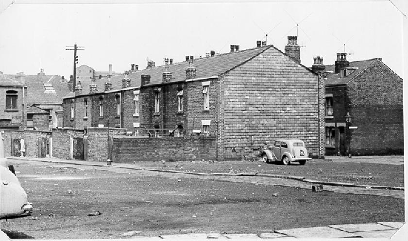
![[back of houses and car]](ardwickstreetandliptrottstreet.gif)
15k GIF 95k JPEG All that is left of the other side of Ardwick Street. May 13th 1964.
This set of pictures are from the Bolton Institute archive, and were taken mostly prior to the tower block being built. The other pages in this set are second, third, fourth and Fifth. The map on the first page should be used to determine the detailed location.
13k GIF 83k JPEG Ardwick Street and Liptrot Street leading onto Derby Street, entrance to Derby Street School. May 13th 1964.
|
15k GIF 95k JPEG All that is left of the other side of Ardwick Street. May 13th 1964.
|
![[houses and cobbled street]](ardwickstreetremains.gif)
13k GIF 89k JPEG The lower half of Ardwick Street and the entrance to Bethel Street. May 13th 1964.
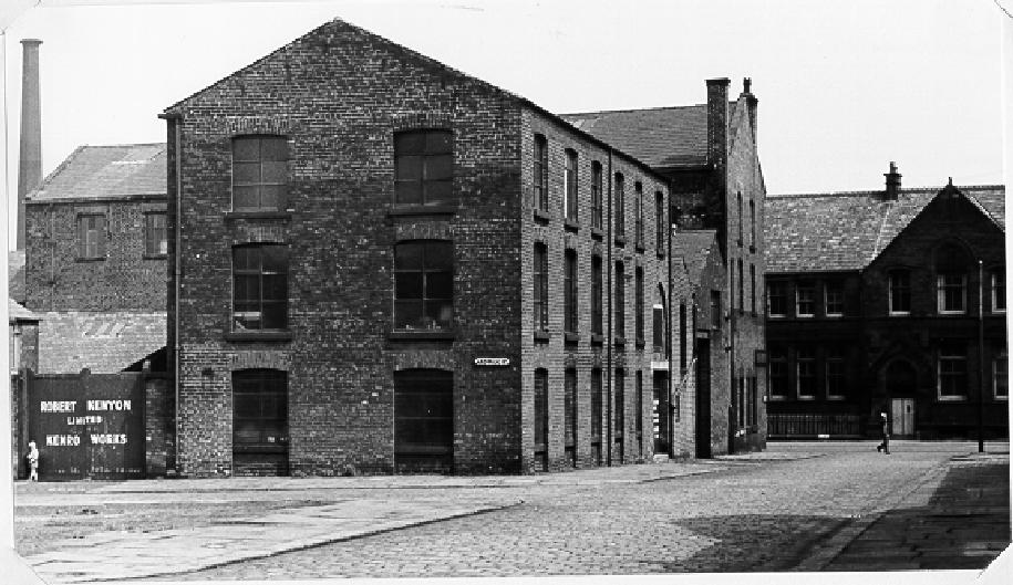
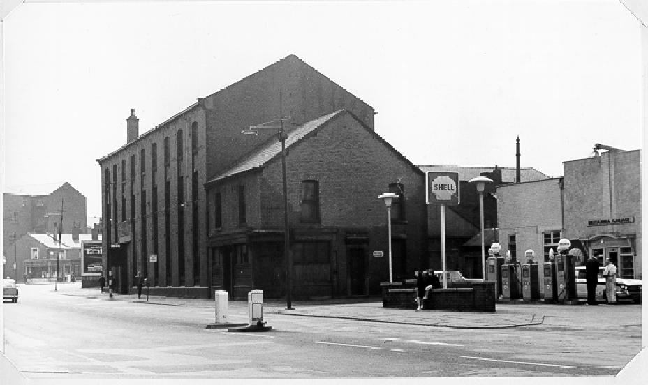
| ![[filling station and buildings]](britanniagaragebethalstreetentrance.gif)
12k GIF 61k JPEG The Britannia Garage and entrance to Bethel Street and the rear of Gregory and Porritts Warehouse. May 13th 1964.
|
![[destroyed houses]](1941bombdamageardwickstreet.gif)
16k GIF 82k JPEG Damage to houses in Ardwick Street as observed from Back Ardwick Street. This property was never restored. October 12th 1941.
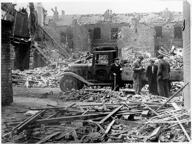
| ![[truck and rubble]](bombdamagejames-ardwickstreet.gif)
19k GIF 132k JPEG Damage to houses in Arkwick Street and Back James Street as observed from Back Bethel Street. October 12th 1941.
|
13k GIF 89k JPEG The lower half of Ardwick Street and the entrance to Bethel Street. May 13th 1964.
| ![[houses and chimney]](bombdamagetohousesroundcroftta.gif)
13k GIF 80k JPEG Damage further to the six houses was also inflicted at this corner plot, which was never made good. The white building is the rear of the Roundcroft Tavern. May 13th 1964.
|
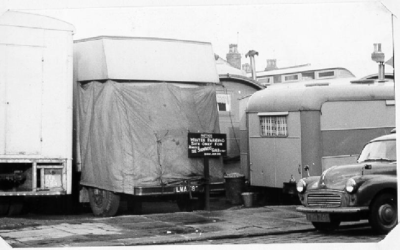
![[caravans]](fairparkingsite.gif)
11k GIF 60k JPEG Fair parking site. January 18th 1965.
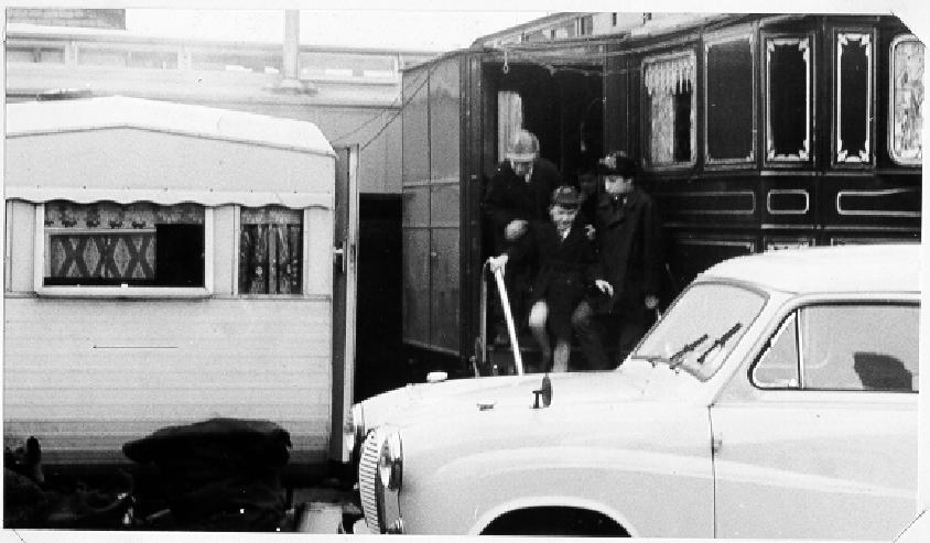
| ![[caravans]](fairparkingsite2.gif)
12k GIF 59k JPEG Fair parking site. January 18th 1965.
|
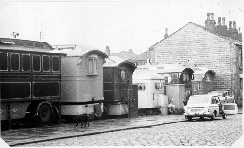
![[caravans]](fairparking3.gif)
13k GIF 66k JPEG Fair parking site. January 18th 1965.
| ![[caravans]](fairparking4.gif)
12k GIF 68k JPEG Fair parking site. January 18th 1965.
|
The other pages in this set are second, third, fourth and Fifth. The map on the first page should be used to determine the detailed location.
These pictures are resampled from the original BMP format, with some slight expansion to the standard size used on this web site. Permission to use these pictures is gratefully acknowledged to Bolton Institute (in particular the Buildings and Estates manager) and they remain copyright.
Please email the webmaster to request additional depth, detailing what you want to see.
DISCLAIMER: Errors and Omissions Excepted.
[Home] [Bolton] [Index] [Gallery] [Webcam] [Updated] [Walk] [Drive] [Links]