[Home]
[Bolton]
[Index]
[Gallery]
[Webcam]
[Updated]
[Walk]
[Drive]
[Links]
Bolton then and now
Access and permission was obtained for a number of pictures of old
Bolton, and some modern equivalent views. This page shows the old and the
new views, and a few old pictures by themselves.
There are also section one,
section two,
section three,
pictures of the
Commercial Hotel and a page for
The Hippodrome. Also see Old Derby area page 1,
two,
three,
four and
Five.
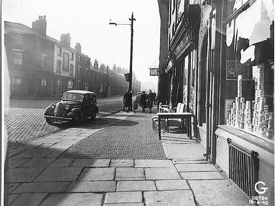
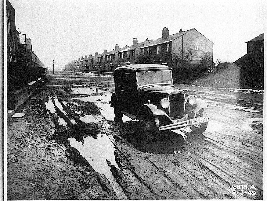
![[houses and cobbled road]](deanerd49.gif)
20k GIF 170k JPEG
Deane Road 1949 (by permission)
From the end of Moor Lane, with Flash Street to the left, this view is down
Deane Road. The fire station is built in this area now. This email came
from David Birtwistle in Toronto. I lived at 4 Deane Rd. from 1942 to about
1945-6 with my mother and
maternal grandparents who owned the cobbler's shop at that address. The
name was Hayes. When my father ret'd from WW 2 we eventually moved to
709 Blackburn Rd. Astley Bridge, until we left for Canada in 1956.
The other photo in "Then and now" section has the fire hall on this
site. When grandmother Hayes lived at #4, she worked as a cook in the
old fire hall!
|
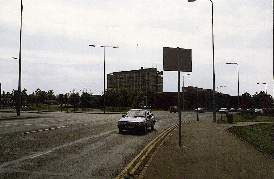
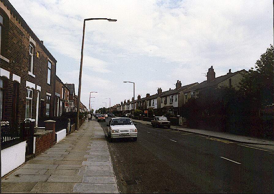
![[tower block and road]](deanerd92.gif)
23k GIF 87k JPEG
Deane Road 1990s (by permission)
Comparing this picture to the previous, a large area was cleared, and
Bolton Institute of Technology, now Bolton Institute
, was built in the area.
|
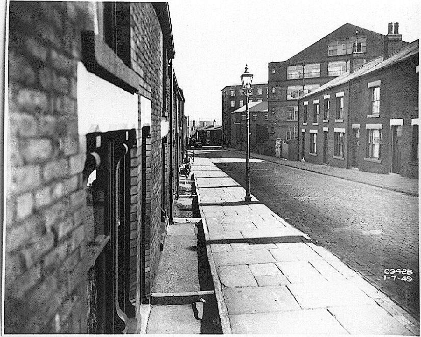
![[cobbled road and houses]](foldsrde49.gif)
19k GIF 161k JPEG
Folds Road east 1949 (by permission)
Eastern view mid way down Folds Road.
|
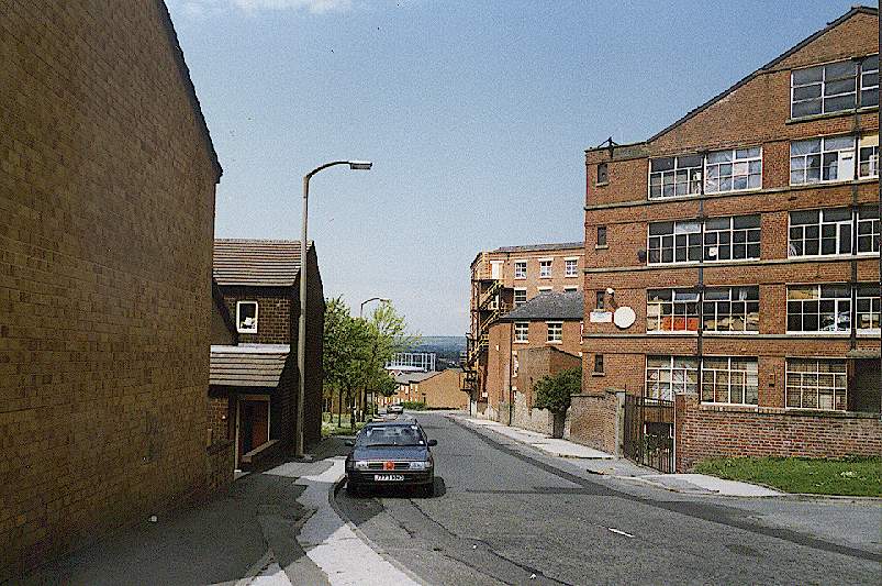
![[road and bridge]](foldsrde92.gif)
24k GIF 110k JPEG
Folds Road east 1990s (by permission)
The modern view of Folds Road shows the bridge, over which St Peter's
Way now runs.
|
![[cobbled street corner]](foldsrdn49.gif)
19k GIF 167k JPEG
Folds Road north 1949 (by permission)
Taken at right angles to the pictures above into a street which no longer
exists.
|
![[land entrance]](foldsrdn92.gif)
22k GIF 90k JPEG
Folds Road north 1990s (by permission)
This is the same area in the 1990s.
|
![[cobbled street and houses]](foldsrdnn49.gif)
19k GIF 161k JPEG
Road off Folds Road north 1949 (by permission)
This is more detail further into the road of which the corner is shown
above. The modern equivalent view is like the modern view above.
![[cobbled street and houses]](fromderbyst49.gif)
19k GIF 147k JPEG
Cannon Street north view 1949 (by permission)
This is Cannon Street and the gasometers can be seen.
|
![[houses and road]](fromderbyst92.gif)
22k GIF 104k JPEG
Cannon Street north view 1990s (by permission)
A modern picture shows the same mills and the same gasometers.
|
![[cobbled street shops and houses]](toderbyst149.gif)
23k GIF 188k JPEG
Cannon Street view to Derby Street 1949 (by permission)
Note the underground accesses.
|
![[path and grass]](toderbyst192.gif)
24k GIF 102k JPEG
Cannon Street view to Derby Street 1990s (by permission)
The area was cleared and is now just a footpath.
|
![[more shops and cobbled street]](toderbyst249.gif)
23k GIF 191k JPEG
Cannon Street view to Derby Street 1949 (by permission)
Similar to the above at a different aspect.
|
![[path and grass]](toderbyst292.gif)
24k GIF 91k JPEG
Cannon Street view to Derby Street 1990s (by permission)
Likewise the modern view.
|
![[unmade road and houses]](ledgelane149.gif)
18k GIF 162k JPEG
Lever Edge Lane 1949 (by permission)
This old view shows Lever Edge Lane in the Morris Green area.
|
![[road and houses]](ledgelane192.gif)
27k GIF 106k JPEG
Lever Edge Lane 1990s (by permission)
The road is now made up but the houses have not changed much.
|
![[unmade road, car and houses]](ledgelane249.gif)
20k GIF 175k JPEG
Lever Edge Lane 1949 (by permission)
A little further down.
|
![[road and cars]](ledgelane292.gif)
27k GIF 106k JPEG
Lever Edge Lane 1990s (by permission)
Comparing the two little has changed in the houses, but the cars are more
modern.
|
![[unmade road and houses]](ledgelane349.gif)
17k GIF 162k JPEG
Lever Edge Lane 1949 (by permission)
A bit further down towards Great Lever.
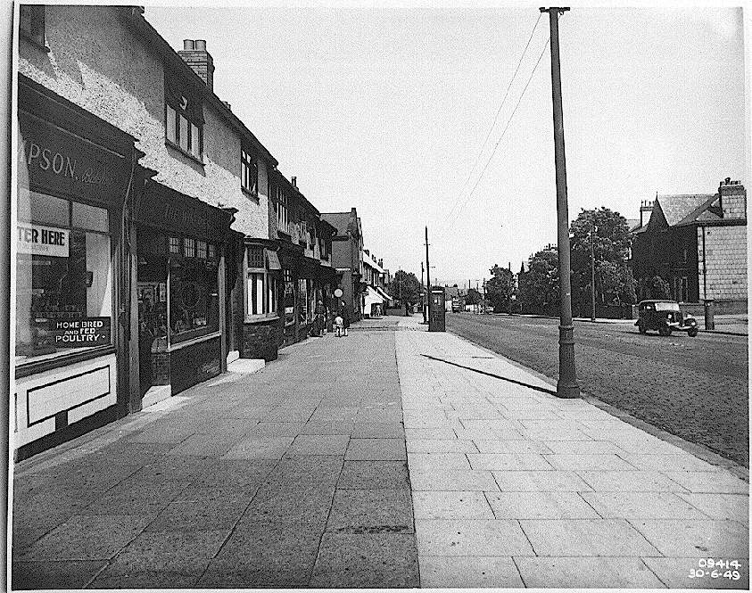
![[shops houses and road]](cor49.gif)
17k GIF 150k JPEG
Chorley Old Road 1949 (by permission)
Looking towards town.
|
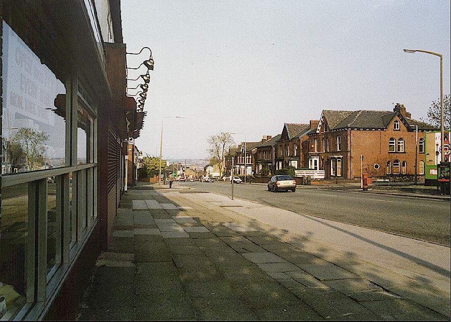
![[road and buildings]](cor92.gif)
27k GIF 126k JPEG
Chorley Old Road 1990s (by permission)
A more modern view looking into town.
|
![[house being demolished]](demo49.gif)
19k GIF 173k JPEG
House being demolished 1949 (by permission)
The middle house is being cleared away.
|
![[old and new houses]](demo92.gif)
32k GIF 165k JPEG
Rebuilt house 1990s (by permission)
The gap between the two older houses has been filled with a more modern
property, but as you can see its in a poor state of repair.
|
![[shops and street]](higherbridgevs49.gif)
21k GIF 172k JPEG
Higher Bridge Street view south 1949 (by permission)
This is mid way down Higher Bridge Street facing towards town.
|
![[shops along road]](higherbridgevs92.gif)
27k GIF 127k JPEG
Higher Bridge Street view south 1990s (by permission)
The same modern view shows that a few shops have been demolished, but some
remain.
|
![[old buildings]](knowsley72.gif)
17k GIF 161k JPEG
Knowsley Street north end 1972 (by permission)
This area was cleared and was a car park for a while, before the market
place shopping centre was built (below). Knowsley
Street.
|
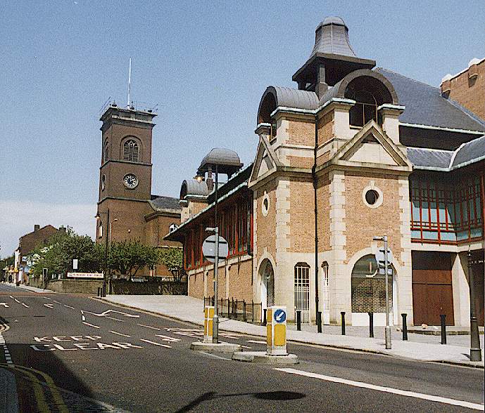
![[road and shopping centre facade]](knowsley92.gif)
22k GIF 96k JPEG
Knowsley Street north end 1990s (by permission)
This is the market place, St George's church (now a craft centre) remains.
Knowsley Street.
|
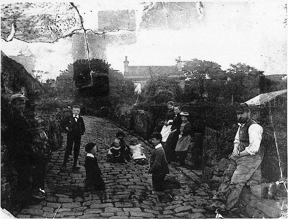
![[people in cobbled road]](oldpic.gif)
14k GIF 189k JPEG
Bolton Scene, date unknown (by permission)
There is nothing known about this picture, if you can help, please send me an email.
I have received this from brian.dann@codetel.net.do.dele.te: (Oct 2002)
Having viewed the old Bolton picture
I suspect the picture titled Bolton scene, date unknown, is a view
along a small road that runs from Cemetery road in Farnworth, around the
cemetery perimiter and finally emerges at the side of what is now the
Information center and office at the Crompton lodges park site. The view
appears to be looking towards Crompton Lodges and I believe that the house
roof in view is the existing information center. (This picture was repaired
by, and with thanks to John Davies-Allen. Original,
222k)
![[parade down cobbled street]](fwmktstold.gif)
15k GIF 148k JPEG
Market Street Farnworth late 1800s (by permission)
This picture from the late 1800s or early 1900s is of the Farnworth Fair or
wakes.
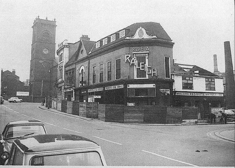
![[large building]](stgeorgeshotel.gif)
17k GIF 157k JPEG
St George's Hotel before demolition (by permission)
At the top of Knowsley street, opposite St George's church was this public
house. It was rebuilt in 1932, closed in 1968, and it
was demolished in 1972, and the Market Place now stands in its place.
![[street end]](knowsleyn72.gif)
17k GIF 169k JPEG
Knowsley Street northern end 1972 (by permission)
Before the demolition in around 1972.
![[old aerial view down street]](stgeold.gif)
14k GIF 171k JPEG
St George's Road west 1970s (by permission)
This picture taken after the demolition of the St. George's Hotel and
surrounding buildings.
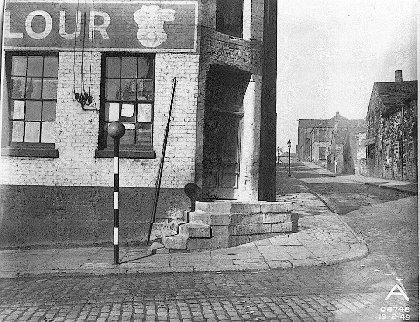
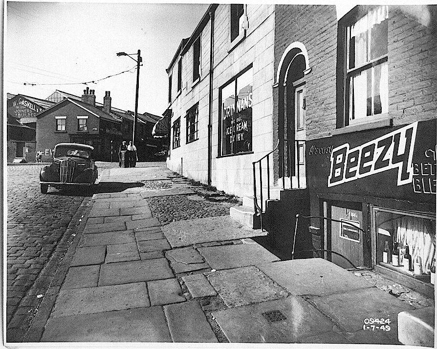
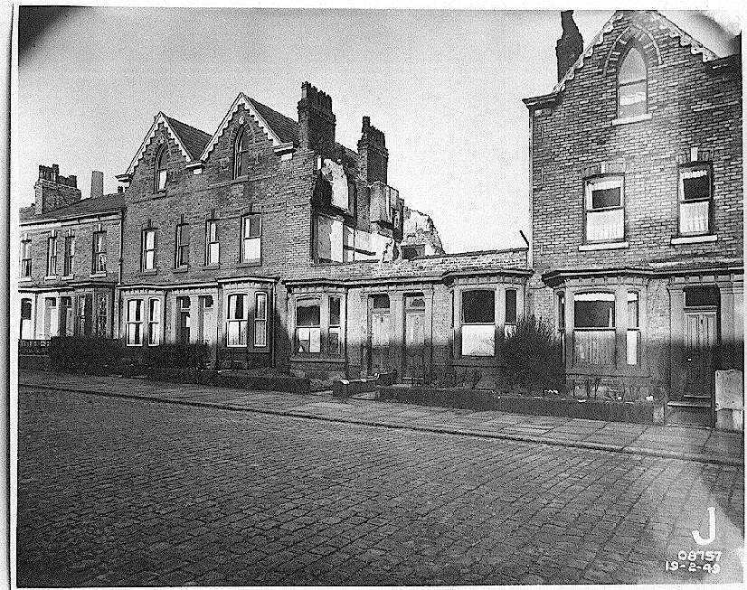
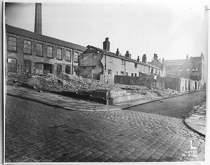
![[cobbled road, partly demolished buildings]](unk49.gif)
18k GIF 167k JPEG
Bolton, unknown area 1949 (by permission)
An email received identifies the area thus:
The area is Lark Street, running between the houses, the mill, the cobbled
street running down the bottom of the picture is Union Street, and the
big building at the rear of the picture is the Spread Eagle public
house, were I used to live, it is now the off road from St Peters Way
heading towards Folds Road and Bury New Road, the mill on Lark Street
still stands today.
|
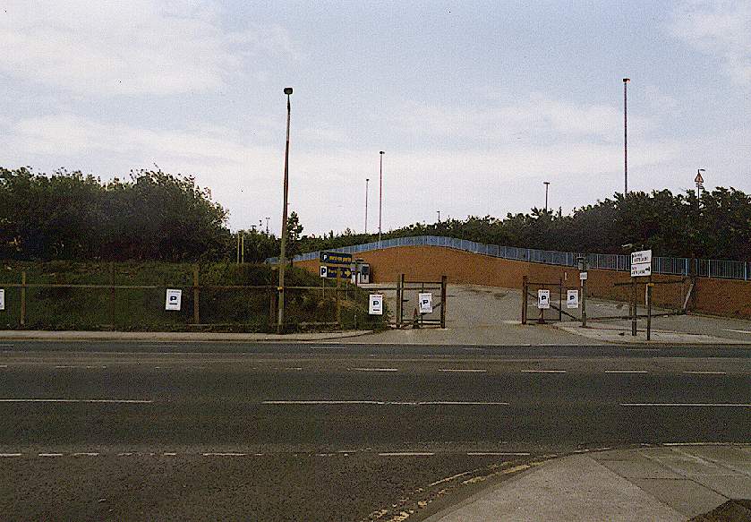
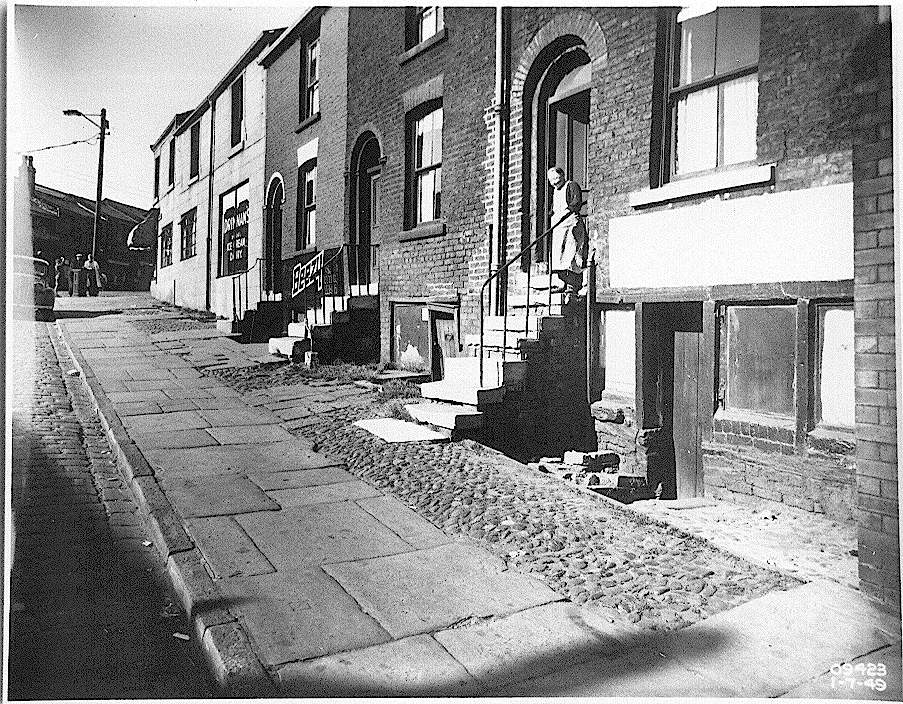
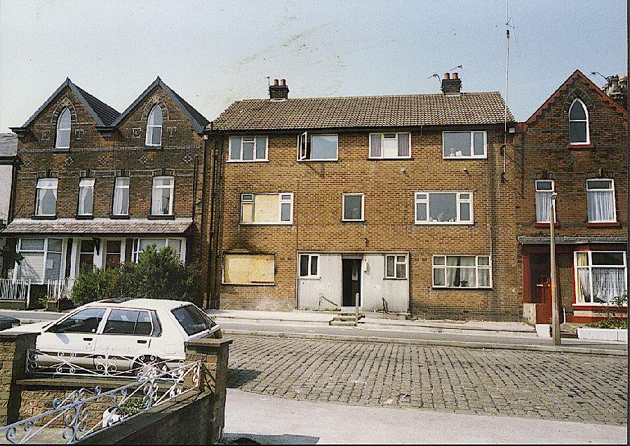
![[factory building]](unk92.gif) This is the building above before its demolition but at a different aspect.
This is the building above before its demolition but at a different aspect.
|
![[train signalling box]](bromleyxnorthbox.gif)
22k GIF 184k JPEG
Bromley Cross North Box (by permission)
As the name suggests, in Bromley Cross this signal box controlled the
signals for Bolton northern railways.
Please email the webmaster to
request additional depth, detailing what you want to see.
DISCLAIMER: Errors and Omissions Excepted.
[Home]
[Bolton]
[Index]
[Gallery]
[Webcam]
[Updated]
[Walk]
[Drive]
[Links]